Table of Contents:
First Nation Cultural Mapping BC Coast | Environment Canada marine weather Hurricane force wind warning | Only blind luck kept disabled Russian freighter afloat (Vancouver Sun, Oct. 20, 2014) | Sinking of the Queen of the North YouTube video |
Oral history goes digital as Google helps map ancestral lands - JUSTINE HUNTER
LADYSMITH, B.C. ? THE GLOBE AND MAIL First Nations can preserve their history by mapping the land on the BC Coast.
Description: A prototype map created as part of the Stz'uminus Storied Places Project...(see full description on Google Map page)
Excerpt: The Stz'uminus Storied Places Project by the Stz'uminus First Nation and the University of Victoria Department of Anthropology includes this map, which plots places of traditional importance and uses names in the Hul'q'umi'num' language. Click through to hear pronunciations and see oral history videos (Read the article on mapsengine.google.com)
Only blind luck kept disabled Russian freighter afloat,
government critics claim
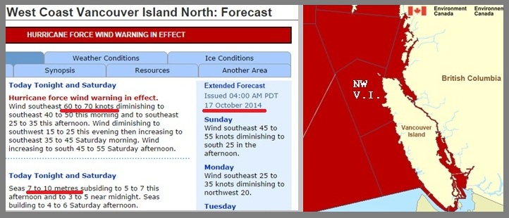
excerpt: .."There have been warnings that B.C. is not prepared for tug rescues. A B.C. government-commissioned study released last year found the
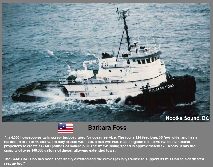
lack of an escort tug system north of Vancouver was a gap in marine safety. The study noted there are *no rescue tugs stationed in B.C. (*see Vol 3 p. 23), Matthew Robinson, Vancouver Sun
| Published: Monday, October 20, 2014
Sinking of the Queen of the North | Wright Sound, Central BC Coast