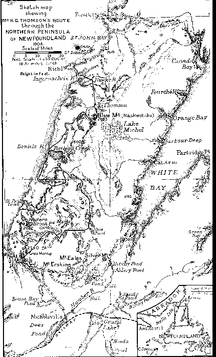
From the paper - "Notes On A Journey Through The Northern Peninsula Of Newfoundland" by H.C. Thomson, appearing in The Geographical Journal, August, 1905; No.2 Vol.XXIV, pp 187 - 198. This part deals with the map resulting from the journey.
Again Howley's high regard for Mattie comes through. Presumably this is the first map to show Lake Michel. Incidentally the map also shows St. John Island , the place where Mattie was prospecting in 1920/21 when he became ill.
The Map can be seen by clicking here.
By H. C. THOMPS0N
THE MAP
On arriving at St. John, I handed the rough sketch-maps of our course which I had made
with the assistance of Michel, to Mr. Howley, who very kindly reduced them to scale, and laid
them down on an Admiralty chart of the northern peninsula. On returning them to me, he wrote,
"While, of course, it cannot lay claim to any such accuracy as an actual instrumental survey, it
nevertheless affords sufficient evidence of approximate reality as to warrant my inserting it
(provisionally) on our general map of the island.
I have little doubt that the main topographical features, as depicted by you with the assistance
of your Mic-mac guide, Mattie Michel, are correct. I know these Indians well enough to be aware
of their acute powers of observation, of which I have frequently availed myself in mapping out
portions of the interior "
Journey Through The Northern Peninsula Of Newfoundland